File:Carpetright store after Tottenham riots.jpg
Original file (4,000 × 3,000 pixels, file size: 1.95 MB, MIME type: image/jpeg)
Summary
| Description |
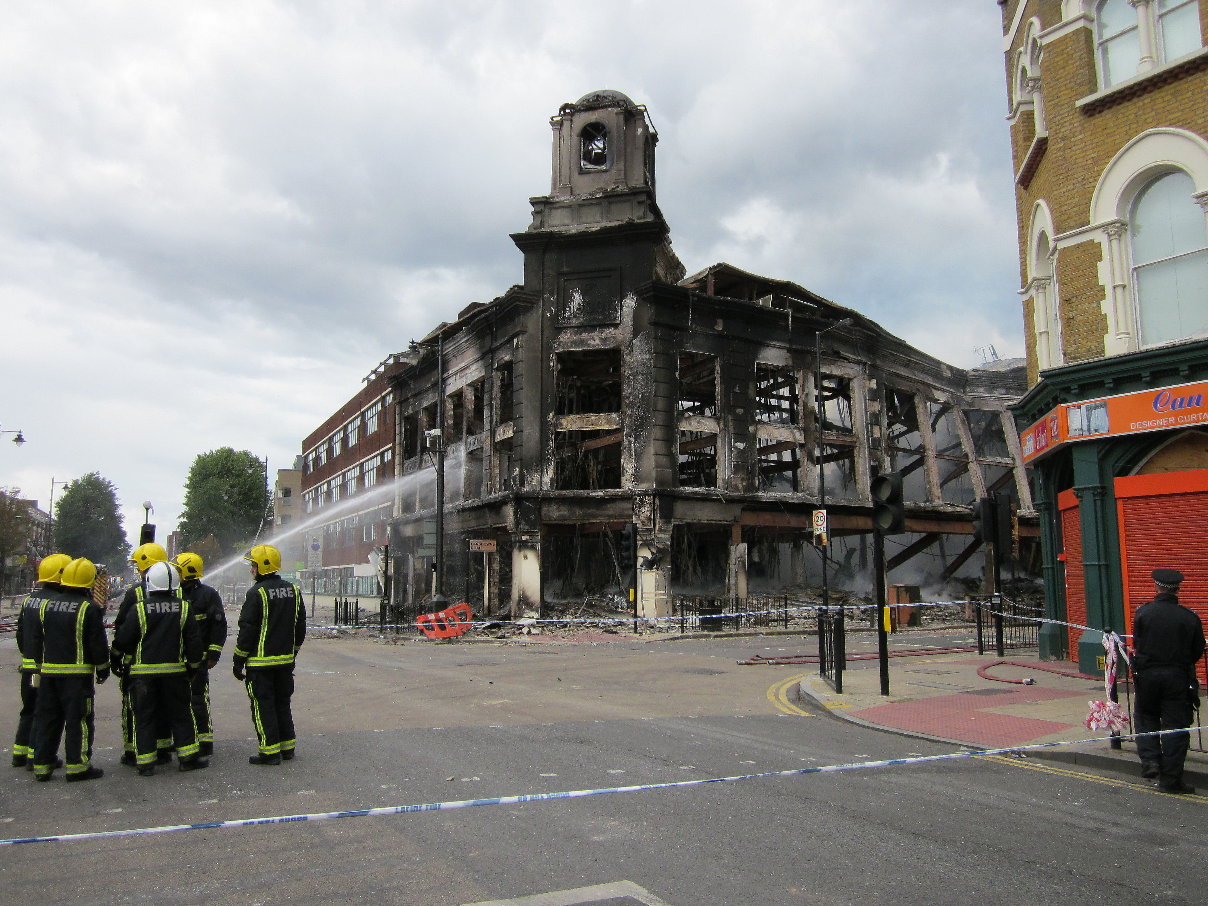
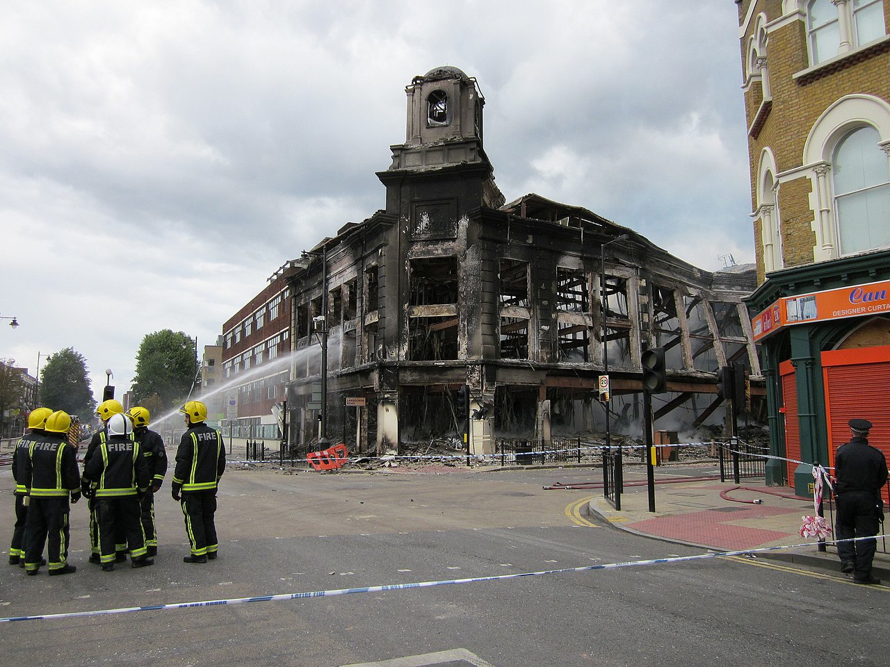
7 August 2011. 2:07 pm. Zena and I walked to the High Road to see the dreadful damage. And spoke to some of the other residents who'd come out. Much of the High Road was taped off by the Police. We weren't allowed near the former Co-op and Carpet Right building which was still smouldering and looked unsafe. ______________________________________ Links § Click for a few seconds of video. § Aerial view of where this photo was taken. § Liz Ixer's photo of the building only a few months before in February 2011. § Gareth Bedford's set of photos - 7 August. |
| Date | |
| Source | Firefighters - High Road Tottenham & Lansdowne Road |
| Author | Alan Stanton |
| Camera location | | View this and other nearby images on: OpenStreetMap |
|---|
Licensing
- You are free:
- to share – to copy, distribute and transmit the work
- to remix – to adapt the work
- Under the following conditions:
- attribution – You must give appropriate credit, provide a link to the license, and indicate if changes were made. You may do so in any reasonable manner, but not in any way that suggests the licensor endorses you or your use.
- share alike – If you remix, transform, or build upon the material, you must distribute your contributions under the same or compatible license as the original.
| This image, originally posted to Flickr, was reviewed on 9 August 2011 by the administrator or reviewer Warfieldian, who confirmed that it was available on Flickr under the stated license on that date. |
File history
Click on a date/time to view the file as it appeared at that time.
| Date/Time | Thumbnail | Dimensions | User | Comment | |
|---|---|---|---|---|---|
| current | 20:02, 8 August 2011 | | 4,000 × 3,000 (1.95 MB) | Yohan euan o4 | {{Information |Description='''7 August 2011. 2:07 pm.''' Zena and I walked to the High Road to see the dreadful damage. And spoke to some of the other residents who'd come out. Much of the High Road was taped off by the Police. We weren't allowed near |
File usage
There are no pages that use this file.
Global file usage
The following other wikis use this file:
- Usage on ar.wikipedia.org
- Usage on bg.wikipedia.org
- Usage on ca.wikipedia.org
- Usage on cs.wikipedia.org
- Usage on cy.wikipedia.org
- Usage on de.wikipedia.org
- Usage on en.wikipedia.org
- Usage on es.wikipedia.org
- Usage on et.wikipedia.org
- Usage on fa.wikipedia.org
- Usage on fi.wikipedia.org
- Usage on fr.wikipedia.org
- Usage on ga.wikipedia.org
- Usage on gl.wikipedia.org
- Usage on he.wikipedia.org
- Usage on id.wikipedia.org
- Usage on is.wikipedia.org
- Usage on it.wikipedia.org
- Usage on ja.wikipedia.org
- Usage on jv.wikipedia.org
- Usage on ko.wikipedia.org
- Usage on lt.wikipedia.org
- Usage on mk.wikipedia.org
- Usage on ms.wikipedia.org
- Usage on nl.wikipedia.org
- Usage on no.wikipedia.org
- Usage on pl.wikipedia.org
- Usage on pt.wikipedia.org
- Usage on ro.wikipedia.org
- Usage on ru.wikipedia.org
- Usage on simple.wikipedia.org
View more global usage of this file.