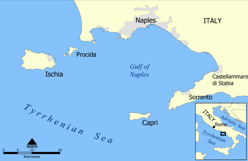
File:Capri and Ischia map.png
Appearance

Size of this preview: 800 × 519 pixels. Other resolutions: 320 × 207 pixels | 640 × 415 pixels | 1,024 × 664 pixels | 1,504 × 975 pixels.
Original file (1,504 × 975 pixels, file size: 142 KB, MIME type: image/png)
File history
Click on a date/time to view the file as it appeared at that time.
| Date/Time | Thumbnail | Dimensions | User | Comment | |
|---|---|---|---|---|---|
| current | 11:59, 19 January 2014 |  | 1,504 × 975 (142 KB) | Andy king50 | some frame remained - removed |
| 11:56, 19 January 2014 |  | 1,506 × 978 (141 KB) | Andy king50 | -frame | |
| 20:23, 26 May 2005 |  | 1,514 × 988 (158 KB) | NormanEinstein | Modified colours. | |
| 14:35, 17 May 2005 |  | 800 × 523 (138 KB) | NormanEinstein | A map showing the islands of Capri and Ischia and the Bay of Naples. Created by NormanEinstein. {{PD-self}} |
File usage
The following page uses this file:
Global file usage
The following other wikis use this file:
- Usage on af.wikipedia.org
- Usage on ar.wikipedia.org
- Usage on ast.wikipedia.org
- Usage on ba.wikipedia.org
- Usage on be.wikipedia.org
- Usage on bg.wikipedia.org
- Usage on bn.wikipedia.org
- Usage on bs.wikipedia.org
- Usage on ca.wikipedia.org
- Usage on cs.wikipedia.org
- Usage on da.wikipedia.org
- Usage on de.wikipedia.org
- Usage on de.wiktionary.org
- Usage on el.wikipedia.org
- Usage on en.wikipedia.org
- Usage on eo.wikipedia.org
- Usage on es.wikipedia.org
View more global usage of this file.

